It's Raining Fish and Spiders (17 page)
Read It's Raining Fish and Spiders Online
Authors: Bill Evans


Amazing as this might seem, it's not too surprising when you realize that many inner-city residents have spent their lives seeking shelter from blizzards, nor'easters, and extreme cold by utilizing the subway.

The second problem is apathyâthe generally held belief that a Category 3 storm will never hit the New York City area. And if it does, New Yorkers feel they will be able to go about their day and just deal with it. It's a syndrome I call “I'm a New Yorker, and I gargle nails for breakfast!” New Yorkers are a tough breed, no doubt, but while they can shovel 30 inches of snow, no one can shovel the ocean.

The devastation will be tremendous and catastrophic, to say the very least. Salt water from the Atlantic will pour into the subway system, killing it. The same ocean will destroy the underground communications systems for the largest and most important financial center in the world, Wall Street. A Category 3 storm will produce a storm surge of nearly 30 feet, higher if the storm arrives at high tide. That would put water in the streets up to midtown Manhattan. The water might reach a height of three stories on the buildings around lower Manhattan, in the area called the Battery and Wall Street.
As the storm leaves, its winds would shift to the northeast, flooding the city from the north. Though the storm will move quickly, racing by at 45 mph, its devastation in this densely populated area would be extreme. It has the smell and feel of another Hurricane Katrina.

New York City officials are well aware of this threat, but as I said, few have experience with such a monster. Officials have a plan that will involve evacuating the three million people who live in the most storm-vulnerable parts of the city. These will not exactly be three million happy-go-lucky-whistling-a-tune evacuees. They will be three million panicked people without a clue of what to expect. I guess that many New Yorkers who live right on the water, the “I gargle nails for breakfast” crowd, will not leaveâlike so many who tried to outlast Katrina in New Orleans.
My nephew Nathan, a sergeant in the National Guard, said that in all his service to our country, in war and peace, he had never seen anything like the situation during the flooding of New Orleans. He actually had to draw his weapon to defend himself from a fellow U.S. citizen whom he was trying to get to leave a flooded home. The flood waters had risen to the roof of the home; he and his fellow soldiers had cut a hole in the roof to help the residents escape from the attic. The guardsmen were attacked by people armed with knivesâpeople who apparently would rather drown in their home than be evacuated. Stranger things will happen in New York City. There's way more people living there.
My point in all of this is to say that people should have a plan of action for when the storm comes.
Notice I did not say
if
the storm comes.
Climatology shows that hurricanes hit New York City. There just may be a long period of time in between.
It has happened before and it will happen again.
Great Hurricane Web Sites >>>>

Try This at Home!
Let's Make It Rain!
This is from the Weather Wiz Kids Web site (
www.weatherwizkids.com
). Since we've been talking about hurricanes in this chapter, let's see how moisture condenses to make rain!
MATERIALS:
Glass mayonnaise or canning jar
Plate (not a paper plate)
Very hot water
Ice cubes
Index cards
PROCESS:
Pour about two inches of very hot water into the glass jar.
Cover the jar with the plate and wait a few minutes before you perform the next step.
Put the ice cubes on top of the plate.
EXPLANATION:
What happens? The cold plate causes the moisture in the warm air inside the jar to condense and form water droplets. This is the same thing that happens in the atmosphere. Warm, moist air rises and meets colder air high in the atmosphere. The water vapor condenses and forms precipitation that falls to the ground.
3
Blizzards

How Bizarre! Blizzards, Snowstorms, and Ice, Oh My!
Blizzards are the worst weather that winter can dish out! Whenever you hear someone exclaim, “It looks like a blizzard outside!” they're generally talking about the nastiest of days. Meteorologists and weather forecasters use the term blizzard to describe a day of heavy snow, biting winds, and low visibility. The term
blizzard
originally meant a cannon shot or a volley of musket fire until an Iowa newspaper used the term in 1870 to describe a snowstorm. Blizzards can occur in any location in the world where snow is naturally made.

National Weather Service, National Oceanic and Atmospheric Administration/Department of Commerce
What Makes a Snowstorm a Blizzard?
Officially, the National Weather Service defines a blizzard as a storm that contains large amounts of snow
or
blowing snow, has winds in excess of 35 mph and visibilities of less than a quarter mile, and lasts for at least 3 hours. When these conditions are expected, the National Weather Service will issue a blizzard warning. Blizzard conditions often develop on the northwest side of an intense storm system. The difference between the lower pressure in the storm and the higher pressure to the west creates a tight pressure gradient, or difference in pressure between two locations, which in turn results in very strong winds. These strong winds pick up any available snow from the ground, and/or blow about any snow which is falling, creating very low visibility and the potential for significant drifting of snow. Cold polar air that whips freshly fallen, fine, powdery snow off the ground creates what is called a
ground blizzard
.
Blizzards can create life-threatening conditions. Traveling by automobile can become difficult, or even impossible, due to whiteout conditions and drifting snow. Whiteout conditions are most often caused by major storms that produce a dry, very powdery snow. In this situation, it doesn't even need to be snowing for there to be a whiteout. When the snow that is already on the ground is blown around, visibility can be reduced to near zero at times.

During a blizzard, gusty winds can knock down trees, bringing down power lines and cutting off electricity for extended periods of time. Often, it can be snowing so hard, at the rate of 2 to 4 inches per hour, that thunder can be heard and flashes of lightning seen. When that happens, it's called
thundersnow
. The conditions for making thundersnow are the same as in a thunderstorm except the precipitation falls in the form of snow rather than rain. It's a very rare phenomenon that happens when very cold air slams into warm air, along a cold or warm front, or a strong storm system that has a very strong upward motion of wind.

How Do You Make That Snowy Stuff?
To me, snow is by far the most beautiful of all of the various forms of precipitation. To put it simply, snow is cool! The way snow is made is really complexâ¦and some parts of the process still remain a mystery. Snowflakes are made from the water droplets in a cloud, just like rain. But in winter, the water vapor is
supercooled
âcooled below freezing and frozen into ice crystals. That happens around 14ºF (-10ºC). Snowflakes are made from ice crystals, pure and simple. Sure, rain can freeze, but frozen rain is called
sleet
and it's structurally very different from snow.
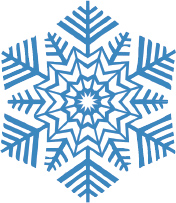
Do you know that most snowflakes have six sides? Do you know why? The water molecules in ice crystals form a hexagonal latticeâthat is, they have six sidesââso when a water droplet freezes, it forms the six-fold symmetry of snow crystals. The most basic snowflake shape is known as a hexagonal prism.
The word
snowflake
is a general term for many ice crystals that have come together. A snowflake can be made up of two crystals or hundreds. A flake's six beautiful points are determined by the amount of ice crystals and the temperature of the atmosphere.
Snowflakes are mysterious things. Their sides and points are symmetrical, and their fundamental form derives from the arrangement of the water molecules in the ice crystal. When a liquid freezes, the molecules tend to settle in the lowest-energy state, and that almost always involves some form of symmetry. The higher the symmetry, the more stable the crystal is.

Dendrite snowflake
Water molecules floating freely in a vapor begin to arrange themselves into a crystalline solid when the temperature drops below freezing. The two hydrogen atoms of the molecules tend to attract neighboring water molecules. When the temperature is low enough, the molecules link together to form a solid, open framework that has a strict hexagonal symmetry.
Why are snowflake shapes so elaborate? Nobody has a good answer for that. The general explanation is that atmospheric conditions when snowflakes are forming are very complex and variable. A crystal might begin to grow in one manner and then minutes or even seconds later, something changes (temperature or humidity), so it starts to grow in another manner. The hexagonal symmetry is maintained, but the ice crystal may branch off in new directions.
These changes in environment take place over a large area compared with the size of a single snowflake, so all the flakes developing in the same region are similarly affected. In the end, all kinds of forms can arise: everything from prisms and needles to the familiar lacy snowflakes. Water is an amazing substance!
The Life of a Snowflake
The shape and size of snow crystals depend on the amount of water vapor in the air and the temperature of the atmosphere. Crystals take on different shapes depending on the amount of time they spend blowing around in the snow cloud and what the overall weather conditions are.
Snow Morphology
There are all kinds of snowflakes, many more types than most of us may have ever thought existed. The amount of moisture and the temperature of the air determine the size and shape of snowflakes. Some flakes are very fine and some are as big as pancakes.
Thin plates and stars grow around 28ºF (-2ºC), while columns and slender needles appear near 23ºF (-5ºC). Plates and stars again form near 5ºF (-15ºC), and a combination of plates and columns are made around -22ºF (-30ºC).

Frank Picini
Snow crystals tend to form simpler shapes when the humidity is low, while more complex shapes form at higher humidities. The most extreme shapesâlong needles around 23ºF (-5ºC) and large, thin plates around -5ºF (-15ºC)âform when the humidity is especially high. Why snow crystal shapes change so much with temperature remains something of a scientific mystery. The growth of snowflakes depends on exactly how water vapor molecules are incorporated into the developing ice crystal, and the physics behind this is complex and not well understood. Most snowflakes are irregular and perfect ones are rare. Next time you are wearing gloves and it's snowing, take a good look at the flakes in your hand. What are they? Are they plates, stars, or needles? Better yet, if you can, get a look at them under a microscope and you'll see that no two snowflakes are alike.
Some people think that “No two snowflakes are alike” is just a folk saying, but it is a true statement and there are many reasons for it. The size and shape of snowflakes are influenced by many things: air currents (which direction the air is moving), humidity levels (the amount of water vapor in the air), wind speed, pressure from the weight of other crystals, the combination of one snow crystal with another, and how long it takes the crystal to fall. There is an infinite variety of snowflakes. You can spend your whole life looking at snowflakes and never find two that are alike!
