Lost in My Own Backyard: A Walk in Yellowstone National Park
Read Lost in My Own Backyard: A Walk in Yellowstone National Park Online
Authors: Tim Cahill
Tags: #Travel

Contents
The Upper Geyser Basin and Old Faithful
The Grand Canyon of the Yellowstone
The River of Reliable Rainbows
A Selected Yellowstone Bookshelf
To my father,
Richard J. Cahill
Introduction
YELLOWSTONE NATIONAL PARK AND VICINITY IS THE
largest intact temperate-zone ecosystem in the northern hemisphere. It is a vast area of earthly riches almost beyond imagining, a natural playground complete with geysers and thermal features so strange that early white visitors referred to the area as “Wonderland.” There are herds of bison and elk, there are beaver and wolves and marmot and osprey and eagles: there is the whole complement of North American fauna. It is not an amusement park, however, and it’s a good idea to pay attention. Yellowstone is a place where the unwary or unlucky can get mauled by a bear, gored by a bison, stomped by a moose, or bitten by a rattlesnake. People also fall off cliffs, freeze to death, and die in avalanches.
Death in Yellowstone,
a book by Lee Whittlesey, chronicles all manner of mishap, but it seems that the easiest way to die in the park is to fall into the water some distance from shore. The temperature of Yellowstone Lake, for instance, averages about 41 degrees. You don’t last long in that kind of water.
I bring this up at the beginning because it is important. Part of the joy of walking in Yellowstone is that it is still, for the most part, a wilderness, which means that it is untamed, which in turn means that it is not impossible to get hurt, even if you follow all the rules. Thus the wilderness that is Yellowstone Park affirms our mortality. That is why walking its trails makes us feel so damn alive.
I have not tried to write a guide to the park. Others have done that and done it so well that anything I say would be redundant. I invite you to turn to “A Selected Yellowstone Bookshelf” at the back of this book for a list of great guidebooks. You will want to know about where to camp, how much things cost, what sorts of accommodations are available, and such like. Books in the back present all this information.
I have also listed a number of trail guides. I use every one mentioned because each is a little different from the others and excellent in its own manner. You’ll find books on the list about the history of the park and about the biology and the geology of Yellowstone. I hope my own idiosyncratic little book will spur you to explore the park, to enjoy it, and to begin doing your own research into those areas that most enthrall and charm you. The books I’ve listed are only a start. My friend Tom Murphy has an entire room devoted to books on Yellowstone, to his wife’s immense annoyance.
Tom and I both live in a town about 50 miles north of the park and therefore consider Yellowstone to be our backyard. Tom, who is best known for his photography in Yellowstone, is also a guide in the park. When not shepherding clients, he likes to bushwhack off trail and “poke around.” I once asked him if he’d ever been lost. “No,” he said thoughtfully, “but there were times I didn’t know exactly where I was.”
That’s happened to me as well. I’ve spent entire afternoons not knowing exactly where I was, which is to say, I was lost in my own backyard. This shouldn’t happen if you stay on the major trails. But you may find yourself lost in thought, or in sheer astonishment. And here’s the big idea for Americans: Yellowstone was the world’s first national park. It was established, by an act of Congress, on March 1, 1872. The park was expressly put aside “for the benefit and enjoyment of the people.” That makes Yellowstone Park America’s backyard. Your backyard.
So let’s go take a walk in the backyard. Let’s get lost together.
The Trails
Day Hikes
Mount Washburn
A
QUARTER CENTURY AGO I MOVED TO A SMALL
town just north of Yellowstone Park. I didn’t know much about wildlife back then and honestly couldn’t tell a mule deer from an antelope. I wasn’t certain why Yellowstone contained more geysers than anyplace else on earth. I was unaware that there was a huge lake, one of the largest alpine lakes on earth, up there in the pines. I didn’t know much.
But I wasn’t a tourist. Oh, no. I was much too cool for that. I never went to Yellowstone specifically to look at, what?—mud pots, or Old Faithful, or various thermal springs. It always seemed to me like that had somehow “been done,” and that serious persons, like myself, went into the backcountry, and we did that specifically to avoid all those other persons who didn’t know that gaping at geysers or giggling at the flatulent-sounding mud pots was for—well, for tourists, who were somehow inferior.
In fact, the places where tourists customarily go are supremely worth seeing even if you have to share the wonder. That is the conclusion I’ve come to after a quarter century of puttering around in the park. Oh, I’ve been out in the backcountry quite a bit, and I’ve seen the tourist attractions, all of them, several times. I just didn’t know how to look at them. I was lost in my own backyard.
I wish someone had just slapped me early on. Well, perhaps I could have done without the slap, but it would have been okay if someone wiser in the ways of the park had just shown me certain things and told me to shut up and listen.
Stop being so damn superior. You’re acting like a jerk.
I have, in fact, a long-standing fantasy in which I take the younger version of myself up to the park and show him the one thing he truly has to understand. It would probably be a hassle getting him through the entrance and up to the summit of Mount Washburn. He’d be asking questions and trying to stop for a walk every time he saw a backcountry trailhead. This young guy would be distracted. I’d have to talk with him in a severe manner.
I imagine it would go like this:
Okay, shut up, we’re going to the park, and it’s going to be a couple of hours of driving, and I’m not going to let you talk about anything at all because you are just going to get all enthralled with this or that and lose the central theme. So here we go, and you might just as well be blindfolded, because we are not going to talk about the mountains that run on either side of Paradise Valley as we rise up Yellowstone River toward the entrance to Yellowstone Park. Oh, those are antelope over there.
Look, stop complaining. I’m taking you twenty-five years closer to figuring out the geological essence of the park. You don’t care about geology? How about the end of civilization as we know it? No, I’m not kidding you. The end of civilization as we know it! Sure, right, make fun. Just another damn thing to worry about. Dumb butt.
Here’s the north entrance the park. We’ll stop, I’ll show my National Park Pass to the ranger in the little guardhouse. Yeah, she’s attractive, I agree. Some of these lady rangers, I have to admit: I mean, if you’ve got a thing for women in uniform . . .
Wait. See how easy it is to let things distract you from the central point? Now we’re passing the forty-fifth parallel, right at the sign there—halfway between the equator and the north pole—and those are elk emerging out of the steam, which comes from thermal springs dropping into the river, and yes, you can bathe in the hot pots there, where the thermal water drops into the river, but that’s not why we’ve come to the park today. Don’t those elk moving through the steam look like they’re in some kind of movie about supernatural beings?
But we’re getting distracted.
And now here we go: we’re driving through the little administrative village of Mammoth. Yes, it’s named for those steaming terraces of multicolored rock looming up over there to our right. Mammoth Hot Springs. Sure, we could stop and take a walk, but there are wooden stairs and wooden walkways and you have to stay on the trail and there’ll probably be a lot of people all bunched together looking at the delicate colors of the various thermal pools up on top of the terraces and you’ll have to hear people say, “Kinda pretty, huh,” and so you don’t want to go up there, do you? You’re too cool for that Disneyland sort of stuff, right?
See, that’s what I mean. I was the same way when I was you twenty-five years ago. Exactly the same way. No Old Faithful for me. Been there, done that, now I’m too cool. This, I’ve come to realize, is a moronic attitude. That’s why we’re going where we’re going today.
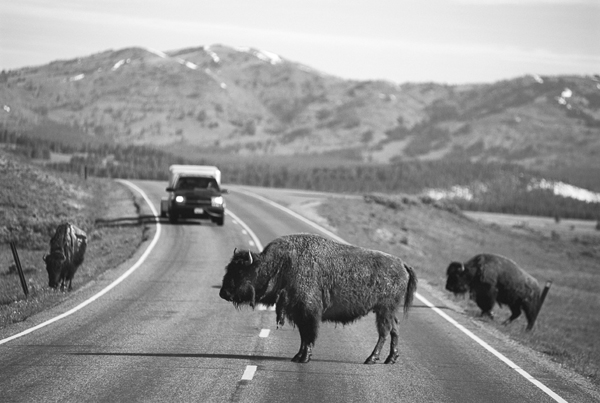
What? No, that’s a coyote. Wolves are bigger. There’re some bison over there. Ignore them, please, as much as you can ignore fifty or sixty animals weighing up to two thousand pounds apiece. Biggest land animal in North America. We’ll deal with them later. We’re on our way to Tower Junction, then we’ll turn south and stop near the top of Dunraven Pass, and then we’ll climb to the summit of Mount Washburn. Why? Because our sole ambition this trip is to begin the process of coming to grips with some of the most significant and convulsive cataclysms that ever occurred on the face of the earth.
But see, here’s the problem with Yellowstone. You can start off on a trip with every intention of trying to understand the ultimate and end up studying wildflowers. The whole park is an embarrassment of wonders.
Okay, so here we are at Dunraven Pass, 8,895 feet in elevation, and here’s where we’ll park. Then we’ll walk up to the top of Mount Washburn. The guidebooks say the walk to the fire lookout on the summit rises about 1,400 feet and should take about two hours (much less if you’re acclimated), and the view from the summit, at 10,243 feet, is said to be soul-stirring.
Yeah, I know, it isn’t exactly your idea of climbing a mountain. This is just a big wide trail, and it used to be a stagecoach road when it was built back in 1905. See those old clumps of asphalt? In the 1920s, when they let cars into the park, people drove up to the top. They drove up in reverse, because Model T Fords didn’t have fuel pumps and you couldn’t get gas to the engine on these steep slopes.
There’s a sign at the trailhead that says, in effect, that Mount Washburn is a “bear frequenting” area and that it is not impossible to be eaten by a grizzly while walking up this trail. I think such signs make one alert. If you tend to worry about bears, and you should, the first part of the trail may seem a little claustrophobic. It is in deep woods, but it eventually emerges onto grasslands set in long sloping aprons, and for most of the summer and early fall these areas are alive with wildflowers. Some say this is the best place in the park to see these flowers, the colors swirling and intertwining like those on an intricate Persian carpet.
Occasionally we’ll get a view of the fire lookout up top, a two-story building with floor-to-ceiling windows, quite a ways off. We’ve been at it for an hour and a half now and passed several people, except for that disgustingly fit couple who were running. Running uphill, hard. Something seriously wrong with those people. Something wrong with the slowpokes we passed, too. We’re walking at the proper pace, the Cahill pace.
Now we’ve got about 300 more feet to the summit, and it’s a steep 300 feet. The trees here—the Engelmann spruce, the whitebark pine, and the subalpine fir—are all stunted and twisted, no more than six feet high, just barely clinging to life on the slope of the mountain. And now the trees are gone, and on either side of the trail the land is lumpy with little hillocks of alpine tundra. Tiny white flowers, smaller than a dime, are all hunkered down low in the rocks to avoid the wind and catch the sun.
The fire lookout is glassed in, and it feels good to stand inside, out of the wind, and look out to the south. There are a few other folks up here, and some of them are signing the guestbook. Only a few hundred have signed the book in the past month, though Mount Washburn is one of the most popular backcountry trails in the park. An estimated ten thousand people make the climb every year. Folks who sign the guestbook have come from Japan and Poland and Switzerland and Connecticut and Oregon and Virginia. There is even some drama in the comments: “Wow! I wish my husband was here. He locked the keys in the car . . . so my six year old son and I came alone while he worked it out. He should have come with us!” Hey, just kick in the window. This is a once-in-a-lifetime experience.
Outside, on the rocks under the lookout, are three or four little furballs, pikas, scrambling frenetically about on the talus slope. These small rodents have one of those jet-propelled metabolisms: they do not hibernate. They just keep busy all winter, burning hot, scampering over the rocks, under the snow. They don’t run fast like hares, but they can outmaneuver most predators on rocky slopes.
In the alpine meadow off to the west are half a dozen bighorn sheep. No rams. Only females and juveniles. They are golden brown in color and lying in the grass, which is almost exactly the same shade of gold. You’d miss them if you scanned the field too quickly.
Washburn is named for General Henry Washburn, the surveyor general of the Montana Territory, who led a volunteer group of citizen explorers from Montana into the Yellowstone country in 1870 to investigate rumors of steam erupting out of the ground and other seemingly improbable wonders. The group had heard rumors of a great lake, but they weren’t finding it. Washburn climbed the mountain we’re standing on and returned to tell everyone that he had seen the lake. Nathaniel Langford, who was along on the trip, later wrote a book about this pioneering expedition and said that Washburn’s information, delivered directly from the summit of the mountain, “has quieted our dread apprehensions. . . . We have spontaneously and by unanimous vote given the mountain the name by which it will hereafter be known, ‘Mount Washburn.’”
So we’ve got pika and bighorn sheep, and a trail that rises 1,400 feet from forest through abundant fields of wildflowers and into alpine tundra. There’s plenty of history here, too, not to mention a view that a later explorer, General William Strong, described as “Wonderland. Grand, glorious, and magnificent.” He also said another true thing: “no pen can write it—no language describe it.”
Many visitors know that most of what we now call Yellowstone Park is the caldera of a giant volcano and that all of the park’s spouting geysers and colorful hot springs and bubbling mud pots are evidence of volcanism very close to the surface of the earth. We all know that.
If you’re like me—and of course you are—you will spend years attempting to visualize the eruption that created the park. You will conjure up in your mind a great big huge gigantic cone-shaped mountain. This mountain would have had foothills to the south, somewhere around Jackson Hole, Wyoming. It would have extended to the north about 50 miles into Montana. This is where my imagination always failed me in the past. The base of the volcano that left a crater nearly the size of Yellowstone, 2.22 million acres, would have had to be several hundred miles in diameter. Mountains aren’t several hundred miles in diameter. Mountain ranges are several hundred miles long. But individual mountains that size don’t exist and never have. I just couldn’t see it, and for a very good reason.
It didn’t happen that way.
The way it must have happened, according to some geology texts I’ve been studying, can best be seen from the top of Mount Washburn, at 10,243 feet. So, okay. Look to the south: there’s the bulk of Yellowstone, which is—this is surprising to many people—a rather flat rolling plain. Absaroka Mountains to the east. There’s the Grand Canyon of the Yellowstone River down there, and part of Yellowstone Lake, and far to the south the Grand Teton range of mountains. If it is clear enough, you’ll see Old Faithful throw a column of boiling water and steam into the air.
The nearest peak to the south is Mount Sheridan, about 37 miles away. It is almost exactly as high as Mount Washburn, give or take about 65 feet. Washburn slopes north, and the southern edge is more abrupt. Sheridan slopes to the south. If you were to clap these two mountains together, you’d have one ordinary roundish mountain.
This fact, among others, has led some geologists to wonder if a whole mountain range had once connected Washburn and Sheridan. And if it had, what in God’s name happened to the intervening 37 miles’ worth of mountains?
The answer is: they blew up. They blew up, and then they collapsed. It happened very quickly. I’m not talking quickly in geological time: it was very probably a matter of hours. Boom, and then there was ash in the air and ash covering the earth from the Pacific Ocean to the Gulf of Mexico. That was about 640,000 years ago. Geologists know this because they can measure the age of rocks.
The eruption blew off the south side of Washburn, the north side of Sheridan, and everything in between went all to hell. It was one of the biggest eruptions in the history of the earth. But there was no immense cone-shaped mountain.
More than likely it was all the result of an ongoing plumbing problem called the Yellowstone Hotspot. Geologists speculate that the earth’s molten core sprang a leak about 25 million years ago. A plume of fiery liquefied rock rose toward the surface of the earth in what is essentially a kind of narrow chimney. About 10 million years ago the molten rock reached the surface of the earth, where it spread out in an immense bowl. The writer Bill Bryson has aptly described the hotspot as looking rather like a martini glass. There are about forty active hotspots on earth at present. They are all located under oceans—except for the one under Yellowstone.
In this hell below the surface, molten rock smoldered close to the crust of the earth, and lighter properties, steam and gases of various sorts, rose to the top of the martini glass. These elements wanted to expand, to explode, but were constrained by the weight of the mountains above. They pushed upward. The land began to rise, humping up like a hissing cat. Ring fractures, great cracks in the earth, formed out at the fringes of the areas where the earth rose.
John Good and Kenneth Pierce describe what happened next in a nicely compact text with an ungainly title,
Interpreting the Landscape: Recent and Ongoing Geology of Grand Teton and Yellowstone National Parks.
Imagine, the authors suggest, a bottle of carbonated water shaken vigorously until the cap blows off. The pressure on the dissolved carbon dioxide (the carbonation) is relieved, and a mass of bubbles and liquid jet up out of the mouth of the bottle. In Yellowstone, when the cap blew, immense fountains of burning hot gases and molten rock and ash blasted into the stratosphere and were carried around the world. (There were likely several years of volcanic winter, when this airborne ash blotted out the sun.) Ash fall covered North America from what is now Saskatchewan to the Gulf of Mexico, from the Pacific Ocean to Iowa.