Map of a Nation (34 page)
Authors: Rachel Hewitt

At the turn of the century, Mudge decided that he needed another
supervisor
to lighten his workload. So in 1801 he travelled to the Royal Military Academy at Woolwich to choose an assistant. One young man instantly caught his attention. Thomas Colby was on the short side, but wiry and fit, with a disarming stare beneath beetling eyebrows and a firm, pursed mouth. This seventeen-year-old showed himself to be ‘well grounded in the
rudiments
of mathematics’, and after further examination Mudge decided that he was ‘perfectly calculated to be employed in this business’. He arranged for Colby to be given a commission in the Royal Engineers with immediate effect, and from January 1802 the young man was permanently attached to the Ordnance Survey.
Thomas Colby came from a deeply military family. His mother’s brothers and her father were artillerymen and Ordnance administrators, and his own father was a Royal Marine. Colby was born in Rochester, but while he was still a young boy his father went to sea and he was sent to live with his paternal aunts in an imposing Gothic mansion called Rhos-y-gilwen, just north of the Preseli Mountains in Pembrokeshire. After being sent to school in Kent, Colby entered the Woolwich Academy. He was a tirelessly energetic young man, who eschewed the temptations of the capital in favour of
rigorous
physical and intellectual discipline. Caring nothing for superficial accolades and praise, Colby applied himself to the hard, rewarding work of military engineering. He was driven, obsessive and utterly perfectionist, but his spartan demeanour concealed a naturally fiery temper whose ‘
overheated
enthusiasm’ occasionally rose to the surface.
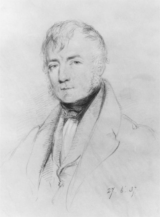
27. Thomas Colby, by William Brockedon, 1837
.
Upon his selection of his new assistant, Mudge tasked Colby with
overseeing
the progress of the Interior Surveying parties while he continued to manage the Trigonometrical Survey. At the end of 1803, Colby joined a party led by a surveyor called Robert Dawson down into Cornwall. Dawson had been intimately involved with the Board of Ordnance since the Trigonometrical Survey’s foundation in 1791. An eager trainee map-maker
who, like Mudge, hailed from Plymouth, Dawson had been talent-spotted in the 1780s by William Gardner, who had arranged for him to be employed by the Board of Ordnance. In 1794, at the age of twenty-three, Dawson
married
Jane Budgen, the sister of two brothers who worked for the Interior Survey, Charles and Richard Budgen.
Within five years of Ordnance service, Dawson’s professional talents had become wonderfully apparent. He was an exquisitely accomplished
draughtsman
whose surveys and plans were works of art. In 1800 the newly founded Royal Military Academy at High Wycombe snapped Dawson up as a teacher of topographical surveying. In 1803 the Ordnance Survey became a school for novice engineers: through short placements with the Interior Survey, cadets from Woolwich could acquire skills in many aspects of surveying and draughtsmanship before entering a range of careers in military engineering. Thanks to his previous pedagogical experience and his irrefutable
map-making
talent, Dawson was given the challenging responsibility of devising a ‘Course of Instruction’ for these trainee map-makers. He insisted on the critical importance of tutoring his apprentices outdoors, immersed in the landscape.
In December 1803 Colby was observing the work of Dawson and his young charges at Liskeard, in north Cornwall. Although the Trigonometrical Survey’s progress was confined to the spring and summer months, this
tutoring
work and some aspects of the Interior Survey, which relied on observations over shorter distances than the triangulation, could be carried out all year round. In Liskeard, a trainee came across ‘an old pair of pistols’ and raced up to his visiting superior to show them off. Colby held the first pistol by its barrel in his left hand and cocked the second with his right. Perhaps playing up to the cadet, Colby braced himself to shoot. But at that moment, the gun that he clutched in his left hand exploded. In an instant, Colby’s hand shattered. Even worse, a piece of the pistol flew into his skull, ‘producing a Fracture in his Forehead’. He collapsed, ‘almost dying’, as a colleague put it.
Dawson hastily gathered up Colby’s small frame and carried him back to his accommodation, where he sent for the local surgeon. Shaking his head regretfully, the surgeon nevertheless, on Dawson’s request, amputated
Colby’s ‘violently injured’ left hand. He also suggested that the young man’s only chance of survival might lie in trepanning: drilling a hole in his skull to release the build-up of pressure caused by the explosion. Shuddering, Dawson refused the operation. Although Colby’s chances of survival were slim after such a horrendous accident, Dawson refused to give him up for dead and devoted himself to his care. Mudge raced down from London to Cornwall to see his young colleague, apprehensive that he would arrive merely ‘to report his death’. But Colby, nineteen years old, refused to die. Blessed with ‘a constitution of unusual strength’ and a devoted nurse in Dawson, who sat by his bedside day after day and night after night for a month, Colby eventually rallied and grew stronger. ‘At length,’ as a friend put it, he ‘triumph[ed] over the effects of this appalling accident, and he was mercifully restored once more to health.’
By the beginning of 1804’s surveying season, Thomas Colby was back up and running – literally. An eccentric young man before the accident, he disliked walking and preferred to jog everywhere, even through the crowded streets of London. Combined with ‘slight peculiarities of dress’, Colby cut an instantly memorable figure. Friends remembered bumping into him as he jogged his way to the Tower, yelling after him to ‘come back, my boy, and take a beefsteak with me’. But Colby never entirely freed himself from the effects of the explosion. He had lost a hand – a terrible thing for a surveyor – and his forehead for ever bore ‘a fearful indent’. Moreover, although Mudge diagnosed that ‘the Brain it seems remains free from any injury; Nor any future evil apprehended beyond a year’, the accident had a permanent effect on Colby’s personality. Within a month of the awful event, the surgeon noted that Colby’s ‘Spirits [were] raised’ and that he had developed an uncharacteristically ‘quick manner of speaking which alarmed Mr Dawson’. Before the explosion, Colby had strived to keep an ‘over-strained prejudice’ under tight restraint. After it, this exertion became even more of a struggle and the young surveyor ricocheted between ascetic self-discipline and
uncontrollable
outbursts of passion.

W
ILLIAM
M
UDGE’S DEVOTION
to the Survey did not lessen as he aged, but his health became precarious and his personality developed a fretful streak that qualified his usual bonhomie. By the middle of the first decade of the 1800s, Mudge realised that he needed a break from the Ordnance Survey. Thankfully Colby was energetic, despite his accident, and his presence meant that Mudge could remain in London over some of the surveying seasons, leaving the tiring fieldwork under his assistant’s able management. In 1804 Mudge took some time out to allow James Northcote, the protégé of his friend Joshua Reynolds, to paint his portrait. He greatly enjoyed the experience, declaring that the artist ‘shall not want the necessary sittings’. But the sheer quantity of work demanded by the mapping project was still so great that Mudge often found himself unable to leave the capital, even over Christmas. When his brother-in-law, Richard Rosdew, wrote in 1804 to invite him for a festive dinner, Mudge declined rather cryptically: ‘I should be very glad to sit down to your sirloin; but when I hear that a
thousand
Artillery are going on the Expedition now fitting out, and also recollect that, but for Triangles and Maps, I might very soon winter elsewhere, I may think myself very well off, although I cannot have that wish [for the sirloin] gratified.’ In 1805 he decided to put physical distance between himself and the Survey, and to look for new living quarters away from the Tower. Mudge wrote to Rosdew: ‘I am not yet settled in a house, my own, either by year, or lease; very difficult it is to find anything hereabouts to be had at hand, but, having two or three kind friends looking out, I hope soon to be covered with a roof of my own.’ But it was to be three years before Mudge moved into his own property, on Holles Street, a small thoroughfare to the west of Oxford Circus, in 1808, when he was forty-six years old.
The Napoleonic Wars continued throughout the first decade of the
nineteenth
century. After a
coup d’état
in 1799, Napoleon Bonaparte had adopted the title of First Consul of France. In March 1802 the Treaty of Amiens led to an uneasy peace between Britain and France, but war again broke out in May 1803. The following year Bonaparte declared France an empire and was crowned emperor seven months later. These developments worried Mudge intensely, who could foresee no other outcome than a French
invasion
of Britain. ‘How retrograde seem to run the affairs of France from the
channel in which we all wish them to steer,’ he wrote to Rosdew. ‘I believe the great question … must be tried on English ground. I shall have my share of it when the period arrives, and so will you; for no man would go further in the defence of his country than yourself.’ But as long as the invasion failed to materialise, the Ordnance Survey was allowed to continue mapping Britain.
At the time of Colby’s accident, the Trigonometrical Survey had started to concern itself with Wales: a region close to the heart of the young surveyor, who had spent much of his childhood near the Preseli mountains. When he was ready to go back to work, he and Mudge headed west. After measuring a series of triangles that travelled up from the Ordnance Survey’s base of verification on Salisbury Plain, through Wiltshire, north Somerset, Bath and south Gloucestershire, the map-makers then made their way through Herefordshire, Worcestershire and Monmouthshire. Before long, they were clustered around the Great Theodolite at Trellech Beacon, just over the border into Wales. Joined to the preceding triangles by sight lines that flew over land and water, over the north of the West Country and across the Bristol Channel, Trellech Beacon was a gateway for the Ordnance Survey’s advance deep into
Cymru
.
Trellech Beacon was positioned on a common at the top of the west bank of the River Wye. Removing his eye from the theodolite’s sights and
standing
tall, Mudge looked north and south to see the thickly wooded concertina of the Wye Valley snaking to the horizon, hill bunched against hill, as if an ornamental fan had been laid on top of the earth’s crust. The wide, flat expanse of the Wye revealed glimpses of itself far below, between each curve of the towering banks. Contemporary visitors to the area reported how smoke issuing from nearby iron-and charcoal-works sidled between the flanks of the river and rested on top of the water like an ethereal feather boa. Poised at this viewpoint, Mudge bent back over the instrument until his gaze was on a level with its eyepiece. He swung the theodolite’s central stack around on its axis and tilted the telescope, until he brought into the centre of the grid of wires that bisected its sights the trig points to the east at which the two men had been standing a few days earlier, at Malvern and on May Hill in Gloucestershire. But Mudge was not alone. Beneath his gaze, a scattered
mob of tourists shifted and shuffled around the contours of the Wye, cooing at its varied views.
Over the last half-century, a home-grown tourist industry in Britain had been steadily burgeoning, propelled by a variety of factors. It was significant that the number of turnpike roads had exploded over the second half of the eighteenth century. Between 1750 and 1815, over 1100 separate turnpike trusts were created, enhancing travellers’ experiences over some 22,000 miles of road. The quality of Britain’s highways was further improved when a Scottish civil engineer called John Loudon McAdam proposed a method of constructing roads by binding stones together with gravel, on a firm base of large rocks, and including a camber at each side to allow rainwater to drain quickly away. (Although the statement is unsupported by historical sources, the writer Thomas De Quincey proclaimed that, thanks to this process of ‘Macadamisation’, ‘all the roads in England within a few years were
remodelled
, and … raised universally to the condition and appearance of gravel walks in private parks’.
1
) Partly thanks to these better roads, there was a rapid increase in stagecoach services: between 1790 and 1836 their number increased eightfold, making journeys faster and cheaper. In 1793 the nation’s tourist industry received a further boost when the French Revolutionary Wars and then the Napoleonic Wars placed the Continent largely out of bounds to British travellers. The writer, antiquarian and soldier Joseph Budworth described how ‘a once-boasted, though now unfortunate, part of the Continent is become a scene of horror and devastation’. Wealthy
families
who would once have pursued the Grand Tour and members of an affluent middle class were forced to travel through their own country instead of Europe. But the experience was made more enjoyable by a change in
sensibility
over the previous half-century, whereby the British landscape had begun to be considered as a source of pleasure and delight.