Map of a Nation (14 page)
Authors: Rachel Hewitt

The laws of motion that Isaac Newton had laid out in his
Principia
Mathematica
had sparked a widespread interest in geodesy. Without proof or evidence, Newton had assumed that the earth had originally been a
homogeneous
fluid mass and he claimed that one of the effects of the law of universal gravitation was that the centrifugal force to which the earth was subject meant that it was not a perfect sphere. Instead, its rotation produced a bulging at the equator and a flattening at the poles, making the earth resemble a less extreme version of a giant Smartie or ‘oblate spheroid’, whose equatorial diameter was longer than its polar one. But geodesists refused to take Newton’s description of the shape of the earth on trust. If his claim was correct, they surmised, then the length of one degree of latitude would necessarily be shorter at the Arctic and Antarctic poles than at the equator. The truth of this supposition could be ascertained through the comparison of two meridian arcs – long lines travelling north–south along the earth’s surface – at two different locations.
In 1735 and 1736 France’s Académie Royale des Sciences dispatched two expeditions to each measure the length of one meridian arc, extending over one degree of latitude. The first, which was led by Pierre Bouguer, was sent to Peru, near the equator. The second went to Lapland under the direction of Pierre-Louis Moreau de Maupertius. Their measurements duly
confirmed
Newton’s theory and indicated that the earth was indeed an oblate spheroid. However, during the course of the Peru expedition a persistent anomaly niggled at the geodesists. In the Andes the surveying instruments did not behave as expected. The plumb lines that were supposed to keep the instruments perfectly poised did not hang vertically: they were deflected
off-course
. In fact, Bouguer was expecting something of the kind. Newton had predicted that mountainous masses on top of the earth’s surface possessed their own gravitational attraction, and that instruments used beside large mountains would find their plumb lines pulled away from the vertical towards the mountain itself. The internal constitution of the earth was then
unknown and geodesists debated whether it was a homogeneous mass, a hollow sphere, or of varying density. Mountains were particularly tricky, as it was not clear whether former volcanoes, such as the Andes, were hollow inside. The results of the Peruvian expedition indicated that the mean density of the earth was considerably more than the density of the earth near its surface. But what perplexed Bouguer was that the deflection
exhibited
by his instruments was very different from his predictions.
In the early 1770s, some thirty-five years after the confusing Peru
expedition
, Britain’s Astronomer Royal, the Reverend Nevil Maskelyne, announced to the Royal Society his intention to interrogate this conundrum of the ‘attraction of mountains’. Maskelyne was a key figure in Enlightenment
science
, whose work at Greenwich Observatory made significant advances in astronomical, navigational and geodetic knowledge. Among other
objectives
, he hoped that his proposed expedition would allow the attraction that was exerted by mountainous masses to be quantified, thus establishing greater knowledge about the relative density of the earth. Maskelyne read before the Royal Society his ‘Proposal for measuring the Attraction of some Hill in this Kingdom by Astronomical Measurements’. The Royal Society duly set up a Committee for Measuring the Attraction of Hills and began to search for a suitable astronomer, mathematician, or surveyor to oversee Maskelyne’s experiment. They chose a man called Charles Mason, who had achieved fame in the mid 1760s by measuring, with his colleague Jeremiah Dixon, a line demarcating the borders of Pennsylvania, Maryland and Delaware as part of a dispute between these British colonies.
1
A few years after his return from this American adventure, the Attraction Committee employed Mason to hunt among the peaks of the Scottish Highlands, Yorkshire and Lancashire for a suitable mountain for Maskelyne’s project. The astronomer was exacting: he specified that this
should be ‘a broad-back’d massy hill’, which is ‘either an oblong hill (that has not been a Vulcano), or long valley, the long way of either running from East to West or not deviating 30 or at most 40° from that direction, & ½ mile high or deep or nearly so, the hill with as few scoops & hollows as possible & the valley as excavated as possible’. One consequence of the lack of detailed, accurate maps of Britain was that Mason was required to physically scour the landscape for such a perfect peak.
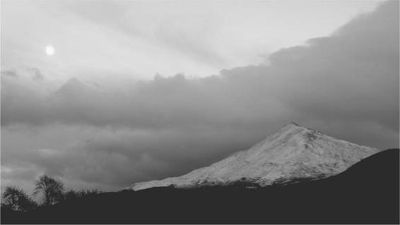
12. Schiehallion at night.
In early 1774 Mason hit the bullseye. He found ‘a remarkable hill, nearly in the centre of Scotland, of sufficient height, tolerably detached from other hills, and considerably larger from East to West than from North to South, called by the people of the low country
Maiden-pap
, but by the neighbouring inhabitants,
Schehallion
; which, I have since been informed, signifies in the [Scots Gaelic] language,
Constant Storm
’. This was, Maskelyne commented wryly, ‘a name well adapted to the appearance which it so frequently exhibits to those who live near it, by the clouds and mists which usually crown its summit’. Schiehallion is positioned in Highland Perthshire at almost the latitudinal and longitudinal centre of Scotland. Its stunningly symmetrical bulk had presided over brutalities in the wake of the 1745 rebellion and later over the Military Surveyors’ efforts to tame Scotland through cartography.
Now the mountain was about to play host to another landmark in the history of human attempts to dominate, civilise and know the earth. But,
unexpectedly
, Mason pulled out of the experiment, ostensibly on financial grounds, although perhaps he had simply lost interest in fieldwork after a career of surveying in South Africa, America and Ireland. Maskelyne was reluctantly persuaded by the Royal Society to conduct the measurements himself and before departing for Scotland he sent an assistant to prepare the ground. Reuben Burrow had previously acted as Maskelyne’s assistant at Greenwich and he would later work as a mathematics teacher at the Tower of London. Now Maskelyne instructed him to establish sites on Schiehallion from which astronomical observations and land measurements could be made. The project’s numerous instruments included a ten-foot zenith sector, which was a long, fragile telescope within a wooden frame, that could be positioned with a plumb line. Burrow transported these delicate artefacts up the conical and stumbly sides of the
mountain
, and he erected tents and a bothy near the mountain’s summit to accommodate those instruments and Maskelyne himself.
On 30 June 1774, Maskelyne arrived, with rather bad grace, to a scene of impeccable order. He spent the next four months living at the exposed and rocky summit of Schiehallion, where he tried to carry out a nightly series of celestial observations and measurements at various points on the
mountain
’s
side to quantify the deflection of his instruments’ plumb lines and to test the accuracy of his newly improved zenith sector. Living a mostly
nocturnal
existence, the astronomer became infuriated by ‘the badness of the weather, which was almost continually cloudy or misty’, and which retarded the observations. In mid July Maskelyne wrote in frustration that ‘it is not but a week ago since I was first able to see a star in the sector (so bad has the weather been) and I have yet had only one good day’. Meanwhile Burrow and a local land-surveyor called William Menzies together conducted detailed surveys ‘to ascertain [Schiehallion’s] dimensions and figure’ and ‘to determine the position and distance of the two stations of the
observatory
’. But the expedition was not unmitigated torture. Maskelyne recollected how he ‘was honoured … by visits from many learned gentlemen who came from a great distance’ to see him perched on his mountain top. In
August Maskelyne’s trial was ameliorated by the arrival of a friend he knew from the Royal Society: William Roy.
Roy had been to Schiehallion before, of course. His first engagement with national map-making had taken place in its shadow during the Military Survey of Scotland. Now, almost thirty years later, Roy was returning as an experienced and respected member of the military, scientific and
antiquarian
establishment. At the summit of Schiehallion he used his barometer to measure the air pressure and, from that measurement, to calculate the mountain’s altitude. Roy then compared his results with those garnered by Maskelyne. Satisfyingly for both parties, the difference between Roy’s and Maskelyne’s calculations of the height of this 3554-foot mountain was a mere three feet. Roy later wrote up the results of his experiments and his conclusion that barometers could provide reliable measurements of
altitude
, and read his article before the Royal Society’s fellowship in four stages, in June and November 1777. Shortly afterwards, he published his report in that institution’s prestigious journal, the
Philosophical Transactions.
Maskelyne’s time on Schiehallion was not as lonely as one might expect. He found the inhabitants of the settlements that orbited the mountain
generous
, polite and interested. He remembered how ‘they often paid me visits on the hill, and gave me the fullest conviction that their country is with
justice
celebrated for its hospitality and attention to strangers’. Today Schiehallion is classified as a Munro:
2
that is, a mountain in Scotland over 3000 feet, a member of one of the loftiest classes of peaks. When I climbed Schiehallion’s tricky upper slopes a few years ago, it was an adventure. I packed a space blanket and Kendal Mint Cake in case of emergency, relied
upon my spring-mounted walking stick and compass, and derived
enormous
satisfaction from reaching the eroded trig point that marks its summit. But the couple I stayed with in Kinloch Rannoch thought nothing of trotting up Schiehallion to watch the sun rise or set, or simply to walk the dog,
carrying
nothing with them, not even water. In the mid 1770s the locals seem to have exhibited an equally relaxed attitude. They took regular meals up to Roy and Maskelyne, and a local boy called Duncan Robertson, known as red-haired Duncan,
Donnaeha Ruadh
, whiled many of the nights away
playing
the fiddle and singing Scottish folk songs to the strange men at the top of the peak.
Roy did not stay long on Schiehallion and Maskelyne himself came down off the mountain in late October. Before he departed, he held a farewell party for the local people who had been so welcoming, in the bothy in which he had lived for nearly four months. The story goes that after copious quantities of local whisky, somehow the revellers managed to set the hut alight. Maskelyne’s instruments and observations remained safe, but Duncan Robertson’s precious fiddle, which had helped to pass so many of the astronomer’s lonely nights on the mountain, was reduced to ashes. Maskelyne promised Duncan that, on his return to London, he would ‘seek you out a new fiddle and send it to you’. The instrument reached Kinloch Rannoch a few months later: Maskelyne had bought Duncan a Stradivarius, whose price, even at the end of the eighteenth century, was well beyond the reach of the average musician. The boy was ecstatic and composed a song to the new violin and to Maskelyne’s generosity. ‘On the trip I took to Schiehallion,/ I lost my wealth and my darling’, it began. But ‘Mr Maskelyne, the hero,/ … did not leave me long a widower,/ He sent to me my choice treasure/ That will leave me
thankful
while I live.’

T
HE
S
CHIEHALLION EXPEDITION
was a success. Maskelyne proved that ‘the mountain Schehallien [
sic
] exerts a sensible attraction’ and his
experiment
contributed to a body of research that proved Newton’s laws to be true. Moreover, Maskelyne had deduced the reason why plumb-line deflections were not so great as predicted: their attraction towards
mountains
was counteracted by another attraction towards the earth’s crust and core, and this meant that ‘the mean density of the earth’ must be ‘at least double of that at the surface’; he happily recorded how this was ‘totally contrary to the hypothesis of some naturalists, who suppose the earth to be only a great hollow shell’. Maskleyne’s Schiehallion adventure was an important landmark in the progress of geodesy in the eighteenth century. It was also a feat of human endurance. When Maskelyne won the Royal Society’s highest accolade for his research in 1775, its president, Sir John Pringle, described in awe to his audience how the astronomer had spent ‘a residence of four months in a mean hut, on the side of a bleak mountain’.